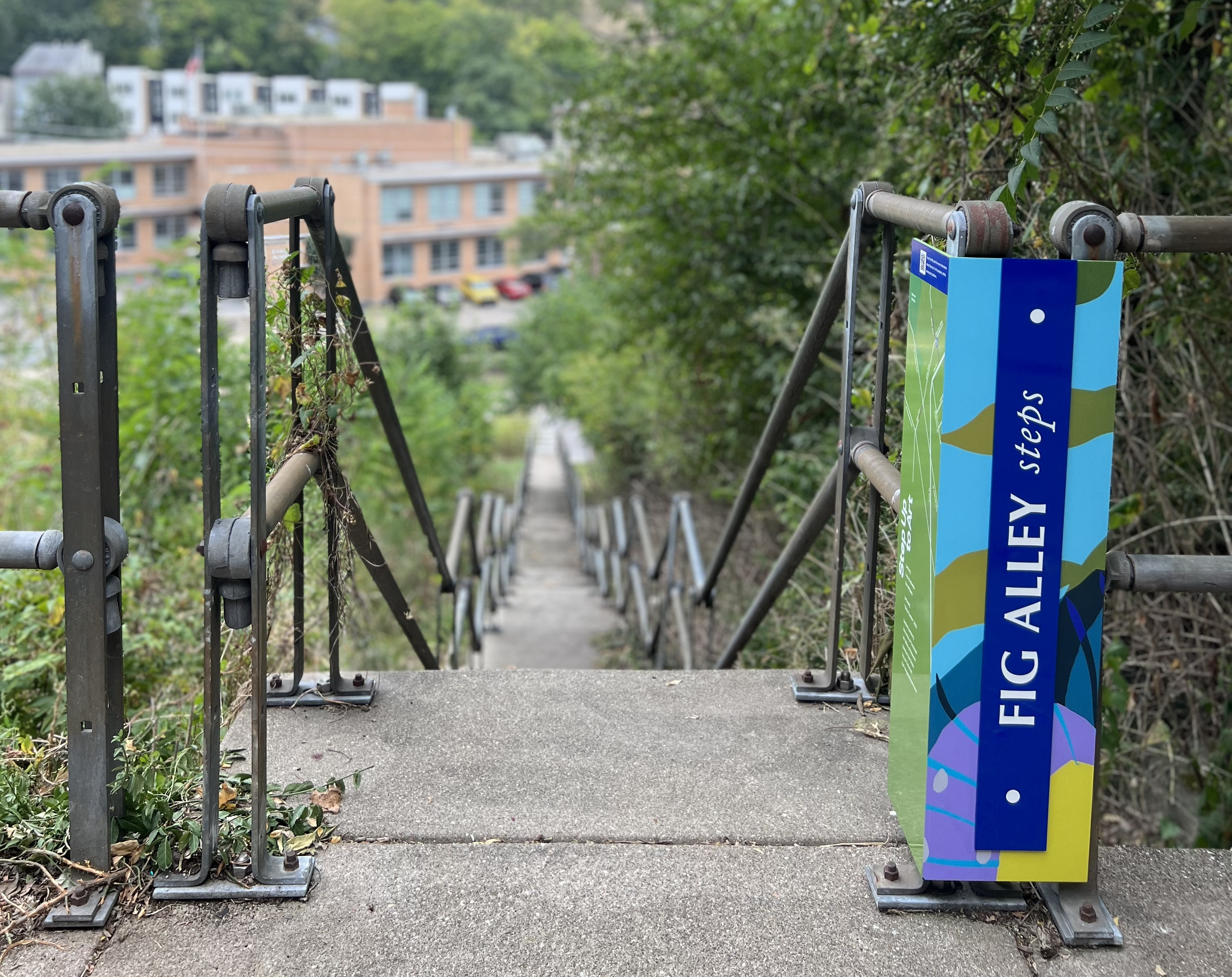
They were unnamed from the 1890s until April 2023, named by City Council ordinance.
The name came from a proposal by Spring in Our Steps and Step Up to Art.
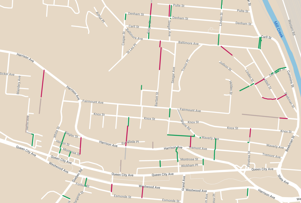
This is a comprehensive inventory of public stairways in Cincinnati, mapped over Winter 2023-24 by Christian Huelsman. After many years of requests for a publicly accessible stairway map, it seemed that the task had to be assigned to self. 384 total stairways and their supplemental data were taken from the City of Cincinnati Department of Transportation and Engineering (DOTE)’s CIty Hillside Stairway Inspection Summary (CHISIS) from 2022. Thanks to American Rescue Plan Act (ARPA) funds, a city maintenance inventory of all public stairways was performed for the first time in a decade. Additionally, numerous repairs to stairways through Cincinnati occurred in 2023, thanks to ARPA funds.
This inventory includes every public alley within the current purview of DOTE. Since the previous inspection summary generated by the department, several stairways were removed from the list (yet one such omission has been included on this map). There will be a second wave of additions to this map that include those omissions, as well the locations of former stairway connections found on historic map resources. While the current City count of stairways totals 383, dozens have been abandoned and either removed or consumed by nature.
Why would someone take on such a daunting, mundane task?
Public stairways are cultural resources and assets located in most neighborhoods in Cincinnati, usually serving residents and visitors for over a century. Some public stairways had previously been constructed of wood, having served as vital connections between otherwise isolated neighborhood areas since the 1870s. When communities are able to locate these resources – whether open and vibrant, closed and squandered, or abandoned and hidden – they are able to advocate for their improvement.
Just as Spring in Our Steps began its work as a band of friends and colleagues wanting to reveal buried brick alley surfaces and overgrown stairways, community members all over Cincinnati will hopefully be empowered by this comprehensive look at public stairways. How they choose to advocate may include: community cleanups, submitting Citizen Service Requests (CSRs) through Cincy 311, and seeking stable or increased funding for repairs through Community Budget Requests via their community council or during annual Capital Budget considerations.
What data is included?
• Name recognized by DOTE
• Neighborhood recognized by DOTE
• Step ID number assigned to the stairway in early 1980s
• Connecting streets and landmarks
• City inspection notes, such as: priority, status, usage, condition rating, and date of last inspection
What other data will be included in the future (where available)?
• Year originally constructed in concrete
• Width of public right-of-way
• Official name of stairway or unnamed status
• Locations of repaired/reopened stairways in 2023-24
• Stairway connections eliminated since 1891 and relevant data
• Information on prior closures
Are all public stairways in Cincinnati named?
No, unfortunately. Only recently, it was discovered that most public stairways remain offically unnamed. The naming of a public street/alley/stairway requires approval through the Committee of Names, then Planning Commission, and City Council. Despite the names you see attached to stairways on the map, they only denote names used by DOTE to identify these connections for maintenance purposes. While some stairways are the continuation of streets, possessing the same name as connecting streets, other stairways connect from dead ends to major roadways via public easements.
Community members can, and should seek to name those stairways through the official process mentioned above. Naming can unlock opportunities to seek regulatory street name signage, help people walking to identify locations by name, and create better legibility of the city for safer walking.
What about alleys? Are they mapped somewhere?
The alley inventory was first initiated in 2015 by Christian Huelsman. It has been updated in three phases since its inception, making use of Sanborn Fire Insurance Maps, property data from the Cincinnati Area Graphic Information System (CAGIS), and historical city documents archived on Google Books. Subsequently, additional GIS data on paper streets has recently been made available, making it possible to distinguish between public ROW that have either been sold or maintained for utility access.
That inventory can also be found on our website: here.
Inventory key:
Open / Closed / Abandoned / Removed
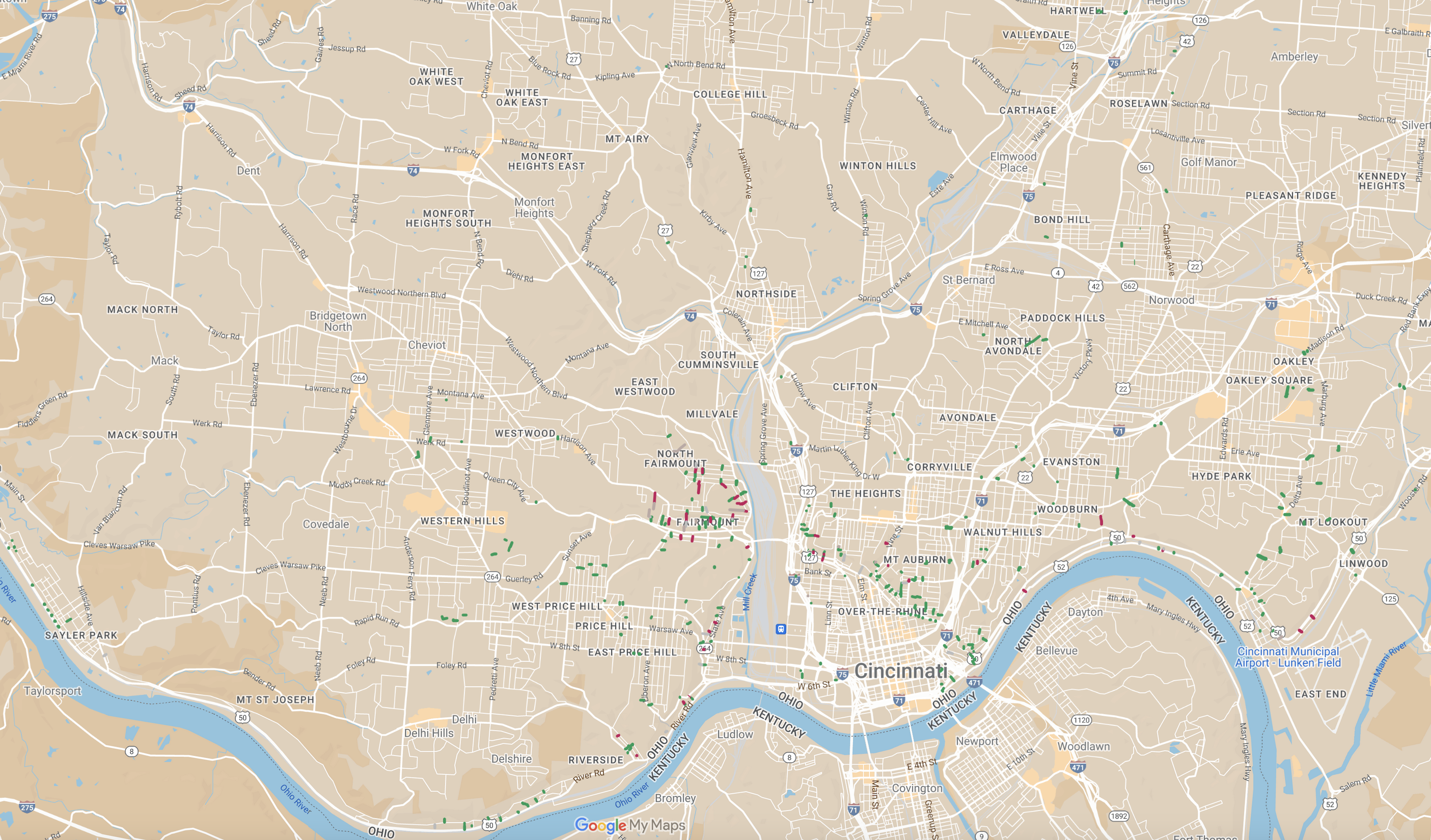
Access the public stairway inventory here.
![The Big FIG Gig!: A Celebration of the Ohio & Fig Alley Steps – SAT September 23 [noon to 3pm]](https://springinoursteps.com/wp-content/uploads/2023/09/375834848_698005712373330_3508767709573141139_n.jpg?w=1024)


Leave a reply to Frank Ernst Cancel reply